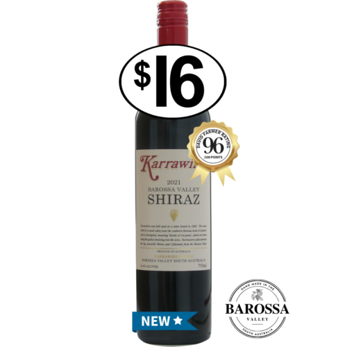
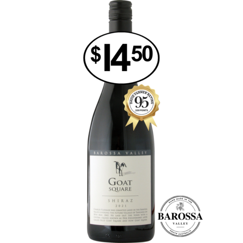
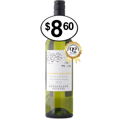
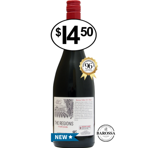
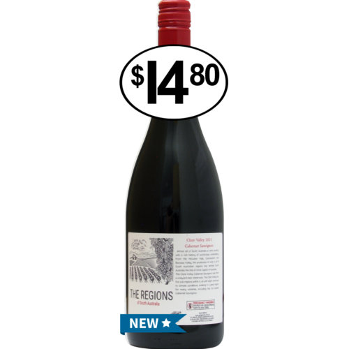
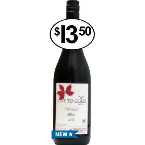
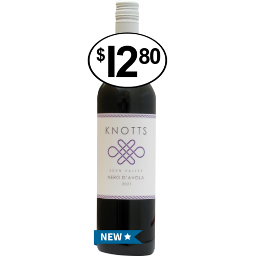
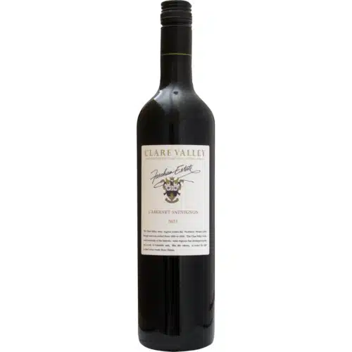
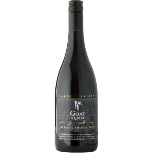
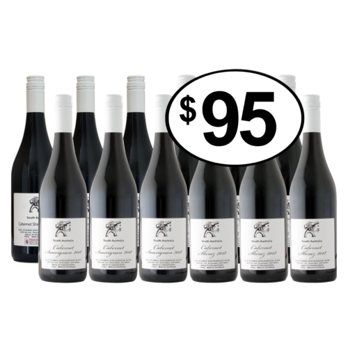
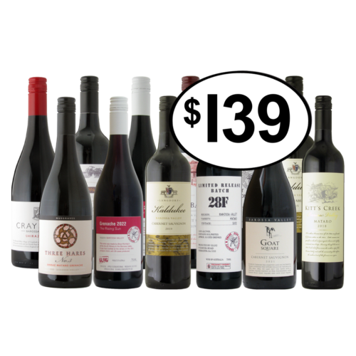
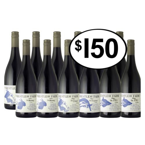
Prelude
Few wine commentators wish to understand the significance of the Murray Basin taking the view that the basin is no more than a maker of industrial wines.
The average wine buyer cannot afford the wines they like to write about and to make price sensitive wines you need regions like the Murray Basin. After all over 60% of the country's wine comes from the Murray Basin while supplying the 30% packaged as casks.
Because the Murray Basin is seen as a provider of basic wines, 'bottled sunshine' being the highest praise; the significance of the region has escaped serious commentary.
The Murray Basin has a particular geographical setting which teaches us a lot about the development of wine flavours. This article is about explaining these features while there is a long diversion summarising the geological formation of the basin (Appendix 1).
This vast region often produces wines of a style which is far from ordinary and there is an admirable show record to prove this. The grower after all has many options about the cropping levels and thus the style of fruit to grow, an option incidentally not available to a grower in a marginal, cool growing region.
Certainly there is an emphasis on tonnage and price but this should not cloud the view that the underlying flavours of the wines are very pleasing. The basins association with volume means the wines are too readily dismissed, often I feel by this prejudice and less by what is in the glass.
The landscape of the Murray Basin is of great interest but like the wines is all too readily dismissed. Thus I hope this account will arouse the curiosity of the cross country traveller. Outback trips across the Australian continent need to be approached in a calm way as landscape changes are subtle and gradual while imposing features are uncommon.
It is the lack of grandeur that induces the tendency to cross the Murray Basin as fast as possible though to understand the basin with its slow flowing rivers needs a contemplative approach and some knowledge of the formation of the basin. Only then is it possible to appreciate the significance of the highlights, such as the Willandra Lake system.
For the student of landscapes and vineyard regions the Murray Basin has a number of important features:
-this vast region is extra-ordinarily flat without physical barriers between the vineyard districts;
-the soils have similar origins and for arguments about a role in the creation of wine flavours are basically the same;
-the vineyards are approximately at the same altitude;
-the region is removed from the influence of coastal, weather patterns;
-the growing season is short, stable and normally uninterrupted by weather events;
-the growing conditions between regions are very similar;
-the diurnal variation across the region is similar; -the vines take water which is dripped from above.
Prejudice about the wines of the Murray Basin has a lot to do with water. However all water is the same and it's a conceit to see wines made from irrigated vines as being inferior to wines made from unirrigated vines. Higher crop yields are not the argument; it is not agreeing that vines use water the same way however it's applied.
So let's have a drink while we explore the defining features of the Murray Basin with its beautiful climate, wonderful vineyards and the hard working farmers who make such excellent wines.
Introducing the Murray Basin
'Meanwhile, up to one-quarter of growers in the most industrial inland irrigated regions are reported to be on the brink of bankruptcy.' Jancis Robinson, Financial Times, 4th April, 2009.
'........In practice this means that they have been grown in the least blessed vineyards, typically a blend of wines from semi-industrial tracts in the heavily irrigated interior.' Jancis Robinson, Financial Times, 7th November 2009.
'Cheap Australian wine used to come from nice vineyard areas, now it's all from inland irrigated areas which aren't great places to grow wine grapes.' Jamie Goode, The Australian, 15th October, 2012.
The Murray Basin and the surrounding ranges which define the basin shape.
The Murray Basin is the source of about 60% of Australia's wine. For grape growers the predictable weather with the warm to hot summer gives a high certainty of a good harvest. The vines grow readily in the red coloured, sandy soils but the environment is artificial as the vines need irrigation to survive.
The shape of the basin approximates an oval being 650 to 700 kilometres east to west and 550 to 600 kilometres north to south. The area of the basin is about 300,000 square kilometres. Vines could grow anywhere over this vast area if water was available. Since a long canal or pipeline to a remote location is costly the grape growing regions are never far from the Murray River and its tributaries.
The major exception is the irrigation town of Griffith, NSW. The Burrinjuck and Blowering dams control the flow of water down the Murrumbidgee River, and near the town of Narrandera a weir is used to divert water along the great canal to Griffith which is the centre of a large horticultural area of vines, citrus, rice, and vegetables.
The viticultural regions of the Murray Basin with their defined boundaries and names are arbitrary concepts as there are no natural landscape divisions which might be used to separate each region.
This vast flat basin is crossed by several meandering rivers, which rise in the Eastern Highlands (The Great Divide), principally the Lachlan River, the Murrumbidgee River and the Murray River. The Lachlan and Murrumbidgee flow into the Murray while further west at Wentworth the Murray combines with the Darling River.
The Darling River flows south-west from a separate basin to the north called the Darling Basin and contributes less than 20% of the combined flow to the ocean. The Darling Basin is not associated with vineyards though vines could be grown.
The Murray Basin is remarkably flat. The basin depression began in the region of Renmark, 60 million years ago, with a later depression centred on Hay.
The significant landscape feature of the basin is its flatness and the slight tilt to the west and south west which allows the Murray River to make its outlet in the far south-west corner of the basin.
The gradient is about one metre ever six kilometres. South of the town of Wellington the Murray River opens into Lake Alexandrina before flowing into the ocean with the nearest town to the outlet being Goolwa.
The main towns and roads of the Murray Basin and surrounds.
Summary of the Geological History of the Murray Basin
To appreciate the wine story of the Murray Basin it helps to understand how the basin formed, or its geological evolution.
A simplification and re-arrangement of the published information of the geological formation of the Murray Basin can be found in Appendix 1. Please note this long appendix has no bearing on wine flavours.
Three issues are of interest in considering how the Murray Basin evolved;
1) The period covers a fundamental change in climate across Australia from lush, sub-tropical and temperate greenery to a parched dry land; with the critical years being 20 million years to 5 million years ago.
2) For the last 30 million years the Earth has slowly entered an ice age and the steady cooling of Antarctica expanded some 2.5 million years across the Arctic. The accumulation of ice has lowered ocean levels, and altered climates and parts of this story are seen in the Murray Basin.
3) To complete the basin shape required a division or ridge to rise to separate the basin from the southern coastline which is the coastline between the South Australia-Victoria border to Goolwa, South Australia.
For much of its formation the basin was open to the sea and the closure of this 'ocean frontage' to produce the oval shape is relatively recent.
The separation of Australia and Antarctica which began 80 million years ago created the two V shaped inlets in the South Australian coastline, St Vincent and Spencer Gulf's, and the down warp which became the Murray Basin.
The Murray Basin began near the location of Renmark, about 60 million years ago, with a second depression beginning around Hay, 55 million years ago. These two shallow depressions spread over the next 30 million years into a semi oval shape ringed by hills clockwise from the west to the south-east with the southern section open to the sea.
It appears the basin was close to sea level but how much of the southern part was open to the Southern ocean is uncertain. Marine rocks are associated with the south-western corner of the basin.
So close to sea-level was the basin that the ocean flooded the western half on two occasions, 30 million and 8 million years ago.
The closure of southern part of the basin which separated the basin from the southern ocean was gradual and not complete until 2.5 million years ago.
About 2.5 million years ago the Earth entered the current ice age cycle and across the basin this is associated with a change to a dry semi-desert landscape and associated wind-blown soils, dune fields, and sparse vegetation.
The River Murray was blocked south of the location of Swan Reach around 2.5 million years ago creating Lake Bungannia, a giant inland sea, and this blockage was not breached until 620,000 years ago.
During this time the southern ocean was likely just south of this blockage. With the broaching of Lake Bungannia the current drainage pattern would have rapidly evolved.
The Murray Basin has an elevation of 50 to 140 metres (above mean sea level) and this elevation is the result of crustal disturbance and a general decline in ocean levels associated with the growing ice on Antarctica which lead into the current ice age.
The Geography and Geographic Regions of the Murray Basin
The two major rivers of the Murray Basin are the Murrumbidgee of 1575 kilometres and the Murray of 2500 kilometres. Both rise in the eastern highlands and flow west across the plain with a slope of about one metre every six kilometres. The rainfall also declines east to west.
I am not sure how useful it is to divide the basin into sub units but the following are referred to when describing the Murray River region:
The upper reaches of the Murray River.
a. The Headwaters from the source in the Snowy Mountains to Corowa is 450 kilometres.
b. The Riverine Plains covers the 800 kilometre stretch from Corowa to Swan Hill. The river meanders with branching channels. This is the eastern part of the Murray Basin which was not covered by the two ocean incursions.
The term is also used in NSW to represent a large bio-region that extends from Griffith to the River Murray. It is also a geographical term that dates to the 1850s to describe the 'look' of this country.
c. The Mallee Trench refers to the 850 kilometre stretch from Swan Hill to Overland Corner, where the river is well defined and has cut a channel into the plain. Most of this area was flooded by the two ocean incursions and is often called the Murravian Gulf.
The banks of the lower Murray River.
d. The Mallee Gorge is the narrow valley cut into the sediments that extends south of Overland Corner to Wellington.
It is likely until 3 million years ago the Murray Basin was a bit above or below sea level and there was a fine balance between the sinking floor of the basin and the infilling with terrestrial sediments. There were long pauses when the basin was not subsiding and times of subsidence below sea level producing the two ocean incursions.
The Murray Basin plain now sits from 50 to 130 metres. There are two likely explanations; an uplift of the plain and or a lowering of the sea level created by the on-set of the current ice age.
When the dam which created Lake Bungunnia was breached 620,000 years the outflow carved a course to the sea which had dropped many metres below the lake level. This continued to grow to make the Mallee Trench and the Mallee Gorge.
There is a gully or canyon crossing the continental shelf which is the trace of the Murray River from the current outlet across the continental shelf. This is the course of the Murray River at times of maximum thickness of ice when the sea level is much lower than present.
The Vineyard Regions of the Murray Basin
As noted the vineyards spread out along the banks of the major rivers or follow canal networks taking water from the river source. The five major regions, which have been given Geographic Indicator status, termed G.I's, are as follows:
1. Swan Hill: Heat degree days 2138, height 70 metres, with an average mean temperature of 14.3°C. Situated in northern Victoria and centred on the town of Swan Hill which is located along the southern perimeter of the Murray Basin. The GI extends along the Murray River in both Victoria and New South Wales. Heights vary from 60 to 85 metres while temperatures have an average low of 9.2°C of and high of 23.7°C. The ripening period is about 8 days later than the centrally located Murray-Darling region.
2. Murray Darling (Sunraysia): Heat degree days 2150, height of 55 to 70 metres, with an average mean temperature of 13.7°C. A large region centred on Mildura which stretches along the Murray River, north along the Darling River and west to the South Australia border.
3. Murrumbidgee Irrigation Area (MIA, also Riverina, and Twin Rivers): Heat degree days 2201, height variable around 120-140 metres, average mean temperature 13.8°C. Average low is 10°C and the average high 23.8°C. Centred on the town of Griffith.
4. Lower Murray (Riverland): Heat degree days 2084, height 25-40 metres, with an average low of 9.6°C and a high of 24.8°C. This region is centred on the town of Renmark, South Australia.
5. Pericoota: Heat degree days 2100, height of 100 metres with a mean January temperature of 22.8°C. A small region bordering the Murray River centred on Echuca.
The five recognised vineyard regions of the Murray Basin are supported by irrigation schemes. There are many vineyards which are outside of these boundaries.
As mentioned the creation of regions across the uniform landscape while useful references are artificial as there are no natural boundaries. As well there are many vineyards outside of these specified regions as grapes can be grown anywhere across the Murray Basin where water is available.
Thoughts on the Taste of Murray Basin Wines
1. The Broad Landscape and Climate
The series of articles titled Final Thoughts: A 40 year Adventure in Geology, Soils, Landscapes and Wine examines how wine flavours develop and covers three topics; soils and geology, climate and weather and viticulture and winemaking.
One conclusion was that soils and geology, apart from controlling the availability of water, have no influence.
With one variable less to consider this means that vineyard regions across the globe with similar climates and weather must and do produce similar wines.
Since the formation of any landscape is a complex interaction of geology and weathering only occasionally will you find a geographical-landscape similarity between vineyard regions.
While there are wine regions with similar climates and weather there will be enough differences in the geography-landscape to consider each as unique.
Yet despite the vast size of the Murray Basin this is a region where the vineyard regions do share a similar geography and climate-weather pattern. The small differences that exist are discussed later.
To understand the importance of the Murray Basin it helps to view it as an experiment in the production of wine flavours where the important parameters creating flavours are;
-width of latitude, 34°S and 36°S;
-similar elevation from 50 to 130 metres;
-a flat expanse with no disruptive landform barriers;
-nil to little coastal weather influence;
-a warm, short, growing-ripening season (refer to the HDD or heat degree days);
-little to no influence from the water holding capacity of soils since the water is applied by irrigation.
-similar dinural variation.
There are other regions where some of these parameters apply; the central rift valley of California comes to mine, though the vast size of the Murray Basin overlapping latitudes 34°S and 36°S makes it unique.
To understand the idea being expressed it is helpful to compare the Murray Basin with the Argentine wine region centred on Mendoza. Both are dry inland regions with many similarities with the important difference being elevation.
Seen together they are two experiments, one at average 100 metres the other at average 600 metres.
Of course the latitudes are not exactly comparable with the Mendoza region being within 32°S to 34°S. As well the elevated dry plains to the east of the Andes which are suitable for vines extends well north and as far south as vines can grow.
The difference that elevation makes will be discovered in the wine glass though recall another factor makes comparisons confusing and this is the divergent views which apply to viticulture and wine-making.
2. Temperature Elevation and Surrounding Hills
Since the physical factors which can alter flavours are remarkably uniform over this vast region the resulting wine flavours are in turn similar.
Even so differences such as elevation and the way colder air slides into the basin from the surrounding hills is likely to create minor flavour variances between regions. I add however that a close study of Murray Basin wines has made me very wary of suggesting the likely origin of any tasting sample.
Naturally the seven parameters set out above are revealed in the taste of the wines and this is important information which can be applied to understand the flavour development of other regions.
The great significance of the basin is of course the heat of the ripening season and with ample water it was quickly realised that enormous tonnages could be ripened with flavour results which were pleasing.
The importance of this was to make available a range of well flavoured wines at low price points which widened the appeal of wine as an alcoholic beverage.
As already mentioned selected parcels when given suitable treatment can reach a level of quality sufficiently high to surprise all palates in masked tastings.
If in the world of wine the Murray Basin is on the lowest tasting rung, a proposition incidentally I am uncomfortable with, it is still a high base to commence with as the flavours are commendable.
If the journey learning about wine is like climbing then the best starting place is with an understanding of the range of flavours created by the unique geography of the Murray Basin.
Many consumers will be content to stay with these flavours while others will find this grounding useful in solving other puzzles that at first make little sense.
Lastly for those who use the term terroir and believe they understand what is meant by premium wines showing a 'sense of place' I will add that few of the world's wine regions have such a clearly defined sense of place as the vast region of the Murray Basin with its clearly defined bowl bounded by ranges.
3. Travelling West Canberra Murray Basin to the Barossa Valley
A touring road plan from Canberra to the Barossa Valley, over 1100 kilometres.
My thoughts on the Murray Basin and its importance were helped by considering the changing flavours of wine as I crossed the many wine regions on trips back and forth from the Barossa Valley to Sydney.
Imagine you doing the same may help to clarify the flavour profile of Murray Basin wines and how short distances can produce dramatic changes in wine flavours.
The cool climate wine region of Canberra is 150 kilometres inland from the sea at about 600 metres and the gradual descent west to the Murray Basin, sees dramatic changes in flavour.
West of Canberra there are plantings near Gundagai, at 250-300 metres, while before the turn-off to Wagga-Wagga you could detour back into the Great Dividing Range to the vineyards of Tumbarumba, which vary to over 600 metres. These are not far from the apple town of Batlow confirming the observation that apples and cool climate wines seem to have an affinity.
West of Wagga Wagga the landscape changes as the hills are worn down and the landscape evolves into the plains of the Murray Basin with Griffith ahead at 130 metres.
Continuing west the drive is fast and simple as the towns float by. You are not aware of the gentle decline while the occasional rise is a drift of pale to red coloured wind-blown sand.
Expectations rise at Renmark, 30 metres, as the Barossa is close. The Murray River is crossed at Blanchetown, 25 metres, then their is a short drive across the plains alluvial fans before the steep climb up the old Mount Lofty hills to Truro, 350 metres.
This is followed by a quick descent down the Stockwell fault into the Barossa Valley, 230- 300 metres. The distance from Blanchetown was 50 kilometres.
The change in flavours along the length of this trip is remarkable with the big variables being climate and weather, altitude and temperature.
When discussing the finer points of the wines we are drinking it is well to recall the temperature map as it holds many truths. From Canberra to the Barossa Valley traverses temperature gradients which relate very well to the taste of the wine.
The wines from Griffith to Renmark-Blanchetown illustrate the enormous gift that is the Murray Basin and the wines re-produce exactly what the climate and elevation will allow.
Where others see industrial I see warmth and depth, enough flavour to keep happy the legion of drinkers who have abandoned beer, fortifieds and spirits to enjoy a more interesting drink.
From Canberra over the Murray Basin then up the other side to the Barossa Valley is over 1100 kilometres, while the move north is about 0.5° latitude. We have learnt that wine flavours are best thought of as a continuum so we must be cautious in erecting boundaries between industrial tastes and fine wine tastes.
The wines of the Murray Basin are a revelation not a disappointment and that these flavours can be created every year without a miss, in such a short growing season, and with heavy crops is a product to be proud of.
No doubt the amount of fine wine drunk globally will expand but for legions of drinkers, honest flavours at good prices will win the day and providing this will remain a profitable business.
Concluding Thoughts
The numbers grow of those seeing a shadow passing over the Murray Basin and foretell of its decline as a significant wine producer. They argue the future lies in other parts of this vast continent.
Indeed the development of vineyards fringing the continents southern coastal margin and among the higher altitude ranges of The Great Divide has been significant enough in the last 25 years to alter the grape flavour mix for the better.
When the currency is strong great pressure is applied on Murray Basin producers competing as they are in the price sensitive zone. At such times it seems natural to claim that the future for a high cost country like Australia is to make wines that can sell at higher price points.
Those who make these prophesies I think will be wrong. The essay sets out the many reasons why the Murray Basin is a unique and precious global resource and one which cannot be duplicated elsewhere.
Because resource based currencies like Australia's fluctuate wildly it means the long term view is the only one worth having. As well the idea of promoting a future based only on premium wines, is so easy to claim that it is almost trite.
Australia has many strengths but global marketing is not one of these. Of course an aim should be to sell more wine at higher prices but there is no fairy wand to wave and altering perceptions will take a very long time.
There will always be a need for price sensitive wines and to make them with full flavour requires ample sun-shine and water, plus capital and expertise and this combination is not readily duplicated. The resource that is currently in place is not a negative to the image of Australia but a very great plus.
In the late 1990s I often travelled to Griffith and developed a real fondness for the wines. Local full rich reds, some with a hint of oak, were frequent winners in open wine classes and that they sold for a lot less than those from other regions appealed to this wine merchant.
Snap opinions rather than what is in the glass runs deep in wine drinking circles and it is far from easy to divorce knowledge of origin from the actual taste.
More recently I have often stopped at Griffith when travelling back and forth to coastal N.S.W. and have retained my affection for the local reds and whites. I have the view that if all that was available was a big glass of Griffith Durif life would not be so bad.
A wine country needs a large reliable region that every year produces tasty wines. The equivalent of the Murray Basin in a cooler climate zone cannot exist and Australia is most fortunate in having this remarkable gift.
Next: Appendix 1